


COUNTY officers have recommended that vehicles should no longer be allowed to use a historic road to Tan Hill.
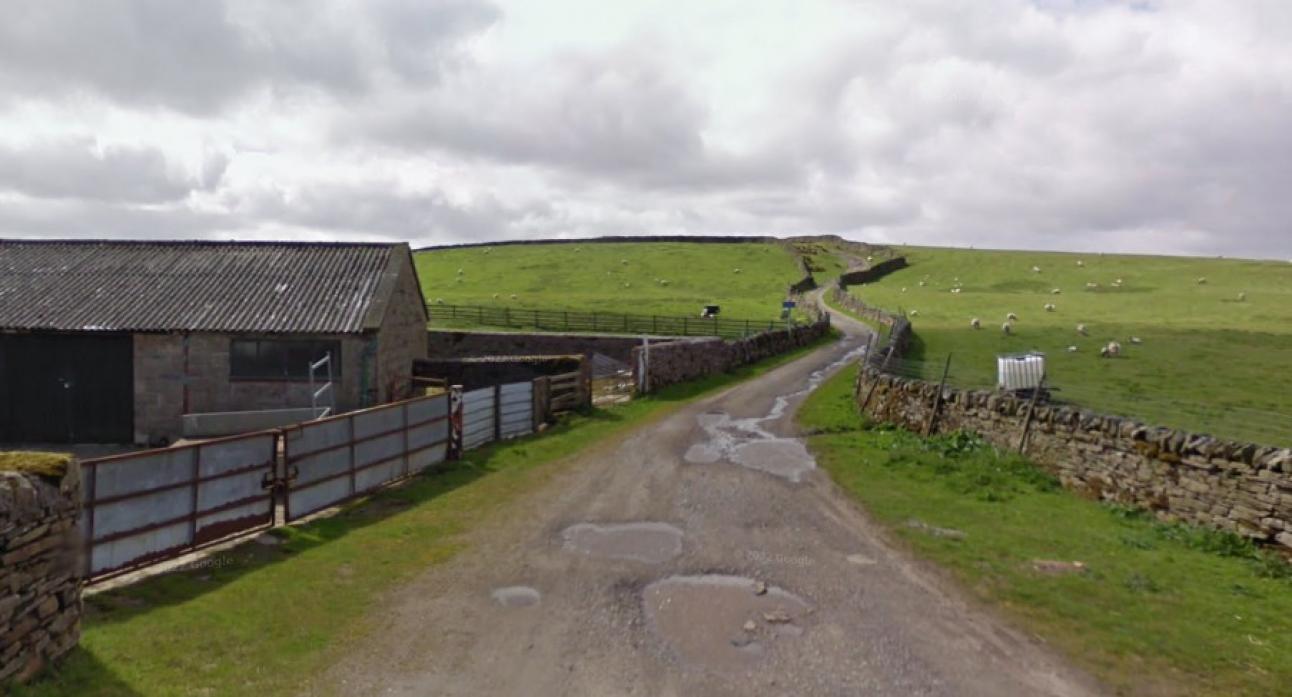
Sleightholme Moor Road, a route between Gilmonby and Arkengarthdale, has been used by the public for centuries. It forms part of the Pennine Way National Trail and the National Cycle Network and leads to Tan Hill Inn.
Motorists have long used the route, which is owned by Bowes Moor Estate, as a shortcut but it has no legal status.
In 2001 padlocks appeared on field gates. An application to have the route recorded as a right of way was then submitted to both Durham and North Yorkshire county councils. Durham County Council's highways committee was due to discuss the issue this week.
County officers have recommended that the section of the route that falls in County Durham becomes a restricted byway – meaning it can be used by walkers, cyclists and horse riders but not motor vehicles.
“While the route is extremely popular and well used by the public, it is not recorded on the Definitive Map nor is it on the Listed of Streets (adopted highway),” wrote map officer Dagmar Richardson.
Bowes Parish Council wanted the route to be open to all traffic.
In a letter, the parish council said: “The chairperson of Bowes Parish Council has said that they have been using the Sleightholme road by Landrover since coming to Gilmonby in 1986. The chairman volunteers at Dales Countryside Museum in Hawes and it is the shortest route. It has been used by parishioners to get to and from Appleby when the A66 is closed due to accidents or bad weather. The councillors feel that this should be kept open, especially during the proposed improvements to the A66.”
Andy Brown, senior rights of way officer at North Yorkshire County Council, also said it should be a highway, stating that Durham County Council has made an error in omitting the road from its list of streets. He also said he has driven on the road.
Minutes from Bowes Parish Council show discussions took place with the county council about maintaining and repairing the road in 1999, 2002 and 2010.
A number of people also submitted evidence to say they had driven along it.
The Barnard Castle County Map by Charles Fowler in 1834 shows the Sleightholme route as a general carriageway. The Tithe Plan for the Township of Bowes in 1850 also showed it as a road and a further map from 1859 describes it as the Sleightholme Moor Road.
Documents from 1930 imply it had public vehicular rights, officials said. Evidence also showed the Sleightholme route on a list of roads to be transferred to Durham County Council from North Riding County Council in 1974 when local government boundaries were changed.
Durham County Council’s report said: “The documentary evidence demonstrates that the route was considered to be an unclassified highway as far back as 1930 and its highway status likely pre-dates the 1859 Inclosure Award for the area. There has also undoubtedly been some public motor vehicular use.”
The report said discussions about repairs do not “overcome the fact that it was not recorded in the List of Streets”.
“It is therefore concluded that on the balance of probabilities that a public right of way as a restricted byway exists over Sleightholme Moor Road, and the route should be recorded on the Definitive Map and Statement as such.
“Whilst the road once had motor vehicles rights the introduction of the Natural Environment and Rural Communities Act means those rights have been extinguished.”
This Act served to end a large number of unrecorded public rights of way for motor vehicles in the UK with some exceptions such as “Green Lanes”.
North Yorkshire County Council has yet to decide on its section of the route.
But Yorkshire rights of way officer Andy Brown said: “My initial thoughts are that for our section it should be recorded as a byway open to all traffic. Common sense would dictate that as a through route it should be the same status throughout.”

